
Türkiye’s Active Fault Map-2026, updated after 13 years by the General Directorate of Mineral Research and Exploration, showed that the number of active faults in the country exceeded previous estimates. The number of active faults, which was determined as 485 in the 2013 edition, increased to 700 in the light of new data. While MTA General Manager Vedat Yanık explained that the update was prepared with the large data accumulation resulting from detailed field studies and academic research, all eyes were on the most dangerous active faults. The new map of MTA was revealed with the completion of the update project, which was included in the investment program in 2022. The increase in the number to 700 in the new map indicated that especially short and medium-length fault segments, secondary faults in the inner regions and fragmented systems in the Aegean-Western Anatolia were processed in more detail.
MARMARA AND AEGEAN REGION
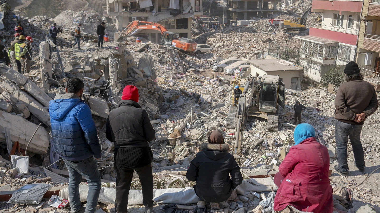
On the updated map, the North Anatolian Fault Zone, which starts from the Marmara Sea and extends eastward along the southern Black Sea, continues to be one of the most critical active fault lines in Türkiye. Almost the entire Marmara Region, Bolu, Düzce, Sakarya, Kocaeli, Tokat, Erzincan line is under the influence of this belt. The Eastern Anatolian Fault Zone, which starts from Hatay and extends to the northeast through Kahramanmaraş, Malatya, Elazığ and Bingöl, is one of the areas that are examined more closely, especially after the February 6, 2023 earthquakes. In the updated map, many short and medium-length fault segments around Izmir, Manisa, Aydın, Denizli, Muğla and Balıkesir constitute one of the most striking concentrations.
110 DISTRICTS ARE RISKY
In MTA’s renewed active fault data, which was previously made public, there were 45 provinces and 110 districts in Türkiye that sit directly on active faults. In this list, provinces such as Aksaray, Aydın, Balıkesir, Bolu, Burdur, Bursa, Bingöl, Denizli, Eskişehir, Erzincan, Erzurum, Hakkari, Hatay, İzmir, Kahramanmaraş, Manisa, Muğla, Kocaeli, Konya, Osmaniye, Sakarya and Tokat stood out. On a district scale, Bozdoğan, Germencik, İncirliova, Kuşadası, Nazilli and Söke in Aydın; Alaşehir, Salihli, Soma and Turgutlu in Manisa; Başiskele, Derince, Gölcük and Kartepe in Kocaeli; Akyazı, Hendek and Sapanca in Sakarya; Erzin, Hassa, Kırıkhan and Payas in Hatay; Many districts in Düzce such as Çilimli, Cumayeri, Gölyaka, Gümüşova and Kaynaştı are mentioned with fault lines.
LOCAL GROUND IS IMPORTANT
While Earthquake Expert Dr. Ramazan Demirtaş points out that the municipality and citizens are undertaking construction according to AFAD’s ‘Earthquake Hazard Map’, he reiterates his warning: “Acceleration values on a parcel basis cannot be understood from a map that does not include local ground conditions.”
BLACK SEA WARNING
Earthquake Scientist Prof. Dr. Osman Bektaş brought the following warnings to the agenda regarding the updated map: “Data regarding submarine faults that will threaten coastal cities are currently lacking. Rizde, Trabzon and Ordu segments, which pass 10 km off the Black Sea coast, are not included on the map. Türkiye is compressed by Eurasia from the north, Africa and the Arabian plate from the south. It should be known that there is no city that will not be affected by the earthquake. There are segments in the Central Anatolia Region that will produce 6 magnitude earthquakes. Acceleration values taken as a basis for structures are for solid ground. However, earthquake magnification occurs in loose soils.”
(email protected)